| 1. Romanian Arrogance Calls For Explanation |
Romanian leadership does not restrict itself to its crude disinformation campaign — it also demonstrates a readiness to engage in provocative and dangerous confrontation, as for example in the three instances below:
Romania hinders free passage of the "Volga"
UKRAINE HAS EXPRESSED ITS ANXIETY CAUSED BY UNFRIENDLY ACTIONS OF ROMANIAN BORDER AUTHORITIES
On October 14, 2004 the Ambassador of Romania in Ukraine Alexander Kornea was invited to the Ministry for Foreign affairs of Ukraine (MFA), where he has been informed about Ukrainian side's reaction on the recent illegal actions of official Romanian authorities in border-line waters of the river Danube.
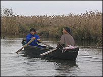
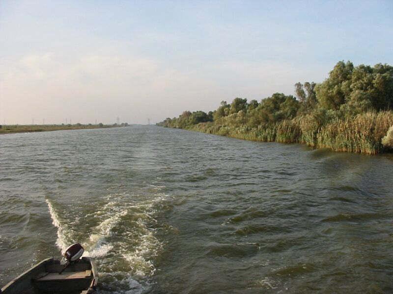
It has been stressed, that at 10 o'clock 14 minutes on October, 9 this year the Romanian border service ship "Frontiera", rudely violating provisions of Article 9 of the Agreement between Ukraine and Romania on the regime of Ukrainian-Romanian state border, co-operation and mutual assistance in border matters of June 17, 2003, was intentionally hindering the free passage of Ukrainian passenger motor ship "Volga" by the main navigation waterway of the river Danube. The aforementioned Romanian border service ship intentionally got up on an anchor at the 37th kilometer of the boundary river Danube in the course of motion of Ukrainian passenger motor ship "Volga" in the middle of main navigation waterway and consciously avoided establishment radio contact with the passenger motor ship "Volga" and with the Center of traffic regulation in Vilkovo.
Such actions of Romanian border guards resulted in creation of the emergency situation and forced the captain of the motor ship "Volga" to change a course and pass outside the main navigation waterway of the river Danube, which threatened the safety not only of the motor ship itself, but also lifes of passengers, mainly citizens of the Federal Republic of Germany, and members of motor ship crew.
Excerpt from a longer report at Ukraine-European Union www.ukraine-eu.mfa.gov.ua/cgi-bin/valmenu_miss.sh?1p01030075.html
|
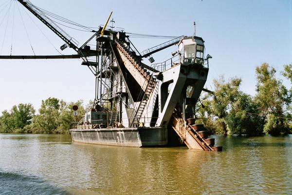
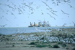
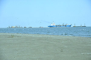
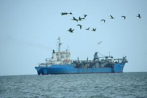
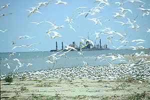
Romania harasses the "Yevhenii Korobochka"
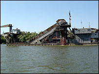
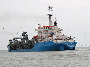
The Ukrainian Transport and Communications Ministry is proposing that the Foreign Affairs Ministry protest to Romania in connection with the provocations on the Ukrainian-Romanian border in River Danube, which involve Romania's obstruction of the operations of a Ukrainian dredging ship that is cleaning the Danube's waterway. [...]
According to the draft note, Romanian border boats obstructed the movement of the Ukrainian special vessel, Yevhenii Korobochka, on September 16 while the vessel was clearing the waterway of silt about 37.8 kilometers inside the River Danube. According to the draft note, the Romanian border boat crossed the path of the vessel at a dangerous distance, thus creating a situation that could have resulted in an accident.
Transport and Communications Ministry Asking Foreign Ministry to Protest to Romania, Ukrainian News, UkraineNow, 21-Sep-2004
www.ukrnow.com/~
|
Romania moves navigational markers
As Ukrainian News earlier reported, the Ukrainian Foreign Affairs Ministry accused Romania on Thursday of unsanctioned shift of the navigation buoy that marked the safe shipping waterway on the River Danube.
Transport and Communications Ministry Asking Foreign Ministry to Protest to Romania, Ukrainian News, UkraineNow, 21-Sep-2004
www.ukrnow.com/~
|
Romanian leadership going so far as to order military units to harrass Ukrainian tourist and dredging vessels, and to shift navigational buoys, might be explained by four causes, of which concern for the environment is not one.
| 2. Romania Is Not Motivated To Protect The Environment |
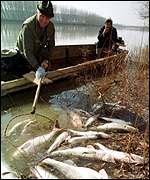
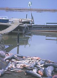
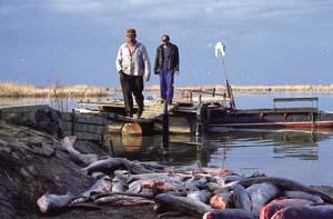
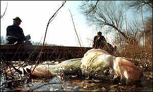
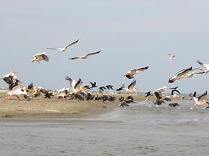
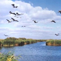
Romania does not want to keep shipping out of the Danube Delta Biosphere Reserve so as to protect the environment � it wants to keep shipping out of the Ukrainian Danube Delta Biosphere Reserve so that it can collect tolls for that same shipping within the Romanian Danube Delta Biosphere Reserve. Using the Romanian Sulina and George Canals for shipping is worse for the delta biosphere because they are its primary providers of nutrients. Every ship that switches from using the two nutrient-supplying Romanian channels to the non-nutrient-supplying Kilia channel benefits the delta ecosystem.
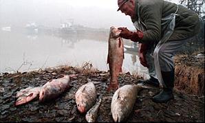
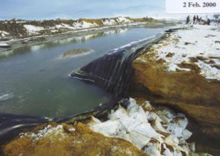
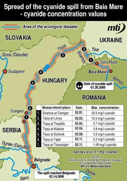
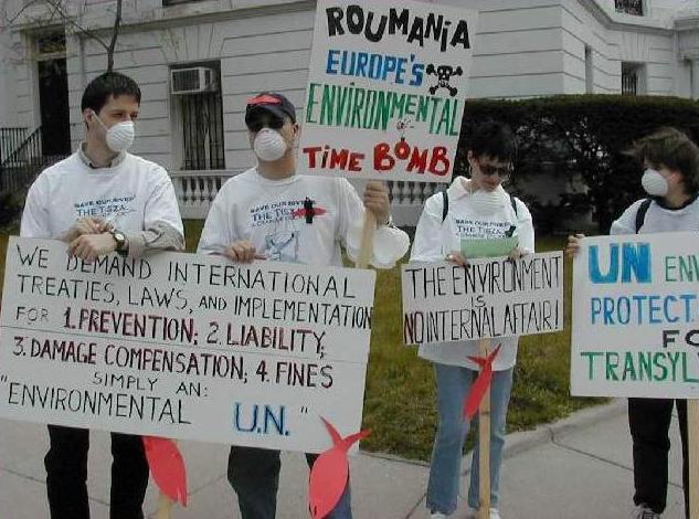
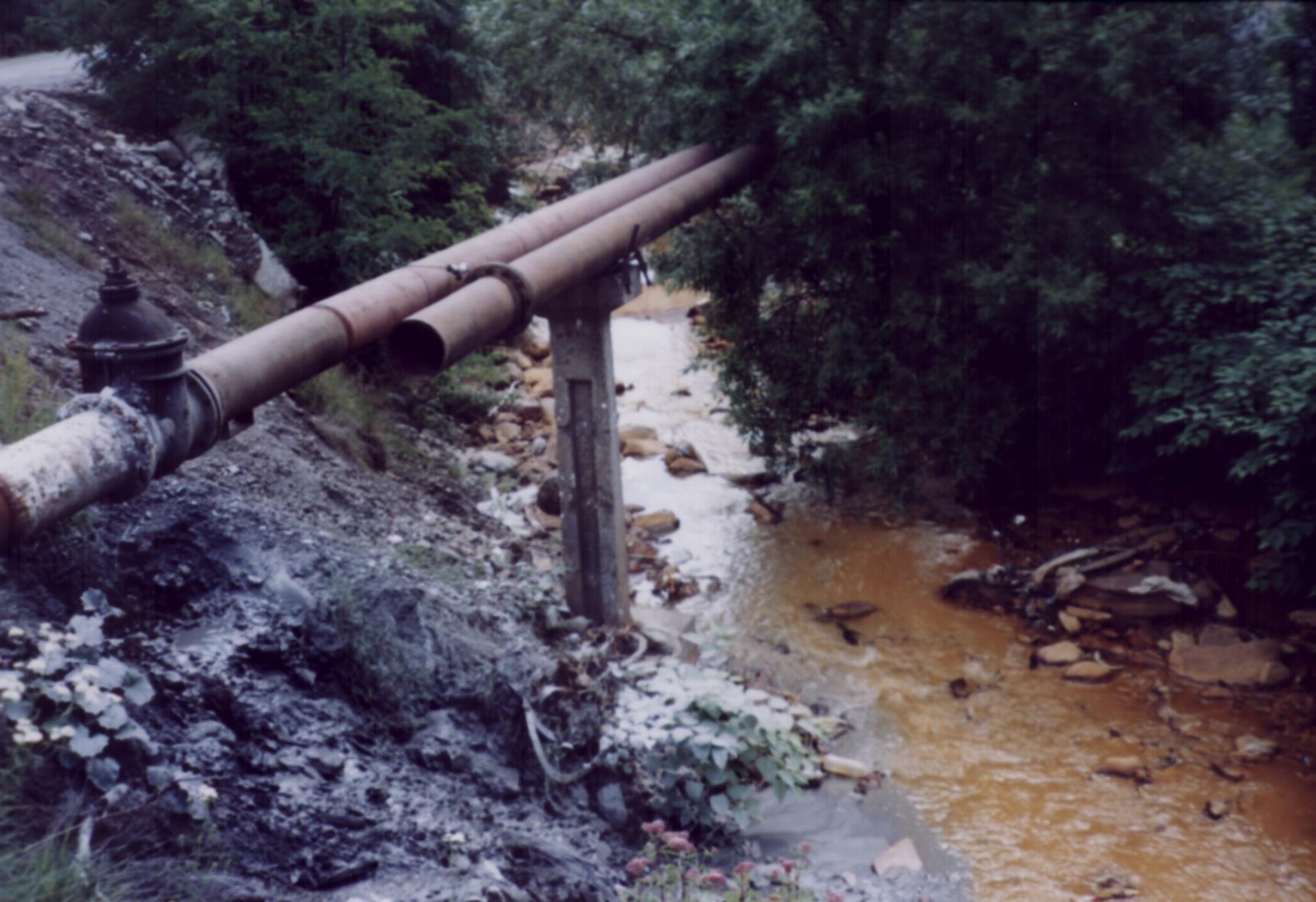
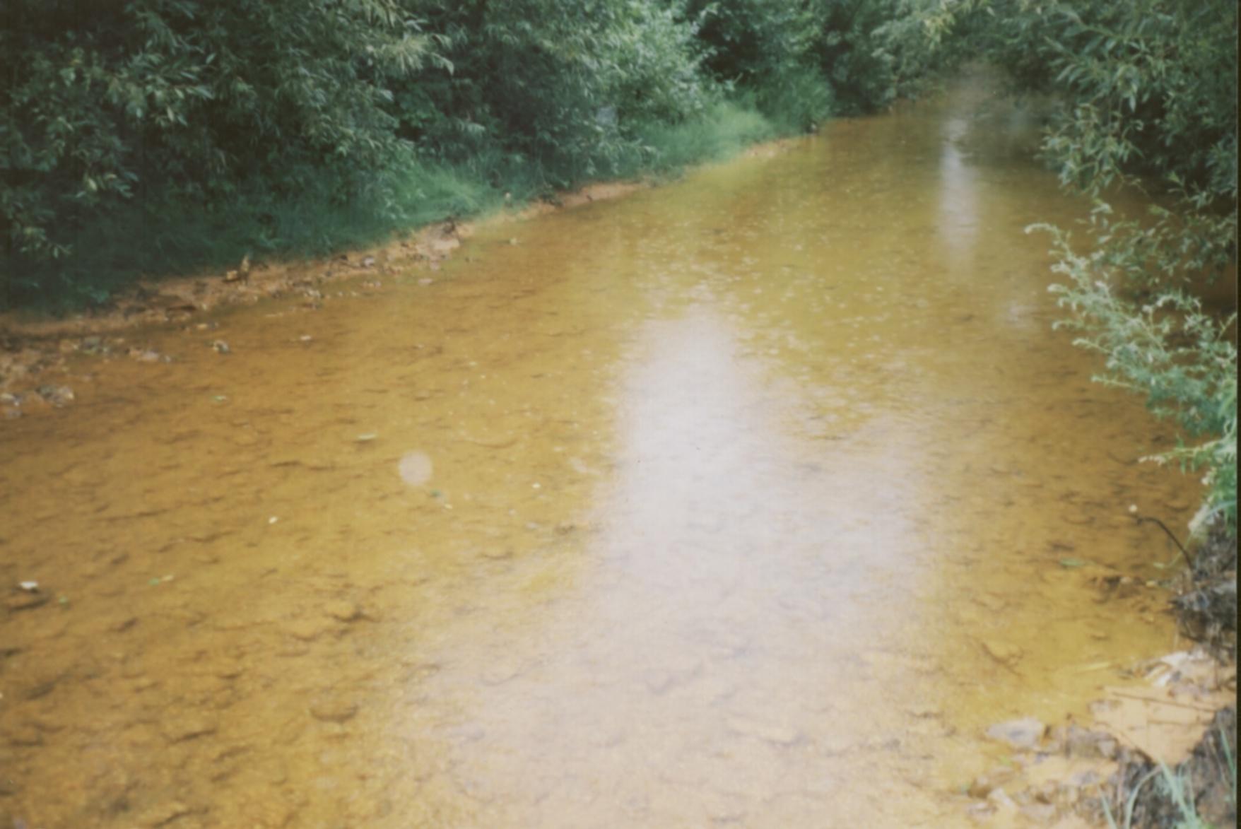
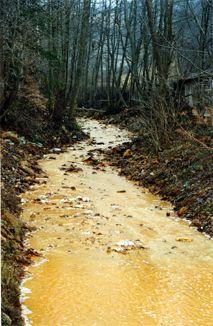
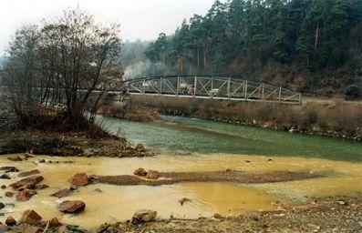
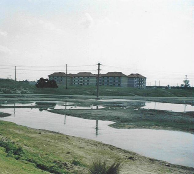
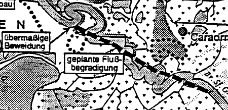
If Romania cared about the environment, it would not today be the Danube River's worst polluter, it would not have a fleet of dredgers at work to keep its network of shipping and boating canals open, it would not be turning the George Channel into the George Canal, it would not be looking for a way to fill the empty Caraorman and the Sfintu Gheorge apartment buildings with workers, it would not be building tourist resorts within the Danube Delta Biosphere Reserve, it would not be diverting water from the Ukrainian Delta to Romanian shipping canals, it would not have mounted an advertising blitzkrieg to attract tourists to the Delta.
It is unfortunately the case that whenever one country demands that another country improve its ecological performance, the best bet is that it does so to advance its own political and economic interests, and that its indifference to the environment can be read in its own ecological record. For example, when Russia objects to Ukraine's Bystre Canal, its aim is to keep Ukraine weak and poor so as to facilitate Russian domination, even as Russia demonstrates its contempt for the environment, as by destroying its own Amur River Basin:

The white-naped crane is one of four rare species of crane which rely on the wilderness of eastern Siberia.
|
|
The cranes of Asia are facing extinction amid Russia's economic anarchy, as multinational corporations and local entrepreneurs plunder the natural resources of Siberia's Amur Basin. [...]
But in recent years, with the easing of hostilities, the ecology of the entire basin has become threatened by precipitate development, not only by Russians and Chinese but by multinational timber and mining interests seeking to loot eastern Siberia; unfortunately, the verb is not too strong. In these times, Russia is too fragmented and chaotic to protect its resources, not only from ruthless corporations but from its own entrepreneurs. Local officials, politicians, private citizens, and even the military, all seeking shelter from the myriad uncertainties, are selling off every asset that is not nailed down. [...]
Many of the Russian reserves � as I learned to my surprise � were created seventy years ago, in the days of Lenin, and have been closely protected ever since, even from the public. But in this dark time of economic anarchy the regional governments are selling off mineral and timber leases, oil and gas exploration and development and even hunting and fishing rights, with little or no regard for the concept of sustainable development, let alone wildlife or wilderness preservation. There is even a rumor of negotiations with the Japanese for concession rights to the crystal water of Lake Baikal. [...]
Peter Matthiessen, The Last Cranes of Siberia, The New Yorker, 03-May-1993, pp. 76-86, pp. 76-77.
|
| 3. Romania Is Motivated To Preserve Its Monopoly |
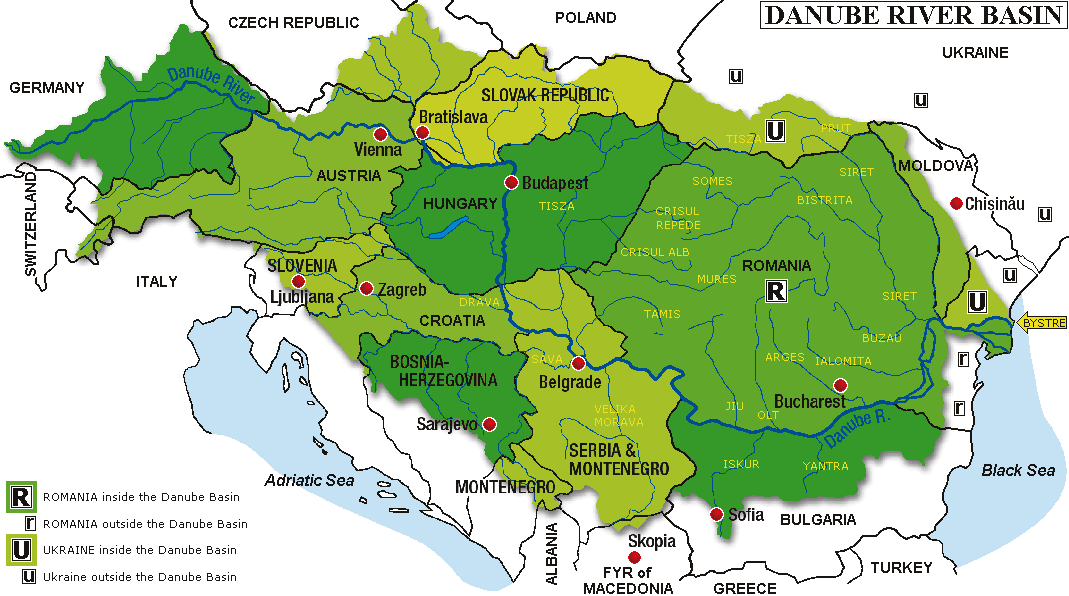
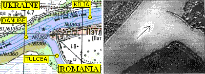
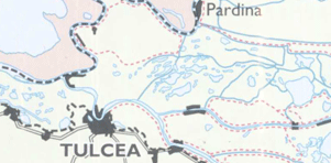
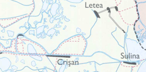
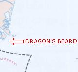
Romania has long held a monopoly on Danube to Black Sea shipping, but is suddenly confronted by a vigorous competitor who proposes to offer a better service at a lower price, and who therefore threatens Romania with a substantial loss of revenue and prestige. The underlying cause of Romania's predicament, as has already been noted above, is that Ukraine and not Romania controls the arm of the Danube best suited for shipping — the Kilia — because all exits from the Kilia to the Black Sea pass through some Ukrainian territory, and none passes through Romanian territory. If Romania owned the Dragon's Beard, then Ukrainian and Romanian authority over the Kilia would be equivalent, the two nations simply sharing opposite banks throughout the length of the Kilia-Starostambulske route. However, such is not the case, and in fact Ukraine dominates the Kilia, and for Romania to retain its monopoly, or at least to slow the rate of loss of its monopoly, it finds the option of sharpening its competitive edge inadequate, and so resorts to disseminating disinformation and to bullying.
| 4. Romania Is Motivated To Acquire Ukrainian Oil And Gas |
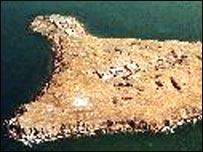
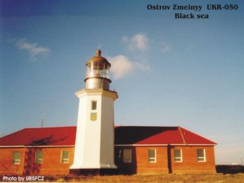
Snake Island, (variously called Serpent Island, Serpents Island, Serpent's Island, O. Zmeinyy or Ostriv Zmeinyy, Zmiyinyy Ostrov, Zmiyinyy Island) is a 17-hectare (42-acre) island 45 km east of the Dragon's Beard, the only island in the Black Sea that is not close to the mainland shore. Although Romanian aspiration to join the European Union has forced it to abandon its claim to owning Snake Island, Romania continues to dispute Ukraine's control over the oil and gas reserves that Ukraine has discovered in the island's vicinity:
Ukraine and Romania Fight Over Oil-Rich Seas
|
The Black Sea — oil under top left red.
|
If preliminary estimates are correct, there might be as much as ten million tons of high-quality oil and even more natural gas underneath the continental shelf of the Black Sea, worth billions of dollars. Incidentally, the oil field lays right underneath the unclear Romanian-Ukrainian borderline, around a small rocky outcrop off the Danube delta, called Serpent Island.
"The matter will be judged only on whether that piece of land above the sea level is a rock or an island; and that will make a huge difference on the map," one senior Romanian diplomat said in an interview with TOL's correspondent. Ukrainians claim it's an island, and deserves its own coastal waters, but Romania says it's just a rock, and has no such international legal status.
Since 'coastal waters' also means a 230-mile strip of exclusive economic rights, that area is huge even though the island itself is just over a mile (1,7 kilometers) around. At more than 5,000 square miles, or a third of the size of the Netherlands, the difference in opinion is enough for the two countries to contemplate taking the case to the International Court of Justice (ICJ).
A copy of the complete article from which the above excerpt is taken is available on ukar.org at
APPENDIX: Ukraine and Romania Fight Over Oil-Rich Seas and as well at the original place of publication at
manila.djh.dk/~. The location of Snake Island can be seen at
MAP: NATIONAL GEOGRAPHIC (look for "O. Zmeinyy" standing for "Ostriv Smeinyy" where "Ostriv" means "Island") and at
MAP: SOIL TYPES.
|
Two clarifications of the above. First, the discovery of oil and gas was made by Ukraine alone, without Romanian participation:
Additional oil and gas have recently been discovered in the Black Sea, but the find is claimed by Ukraine. Romania disputes the claim. In July 2001, the British firm JKX Oil and Gas announced it had found 73 million barrels of oil and 353 billion cubic feet (Bcf) of natural gas. Their find was done in partnership with Cernomorneftegaz Company of Ukraine. The area in dispute is called Zmiyinyy Island by Ukraine. It is called Insula Serpilor (Serpents' Island) by Romania. Romania is already producing oil in the area west of the island and sending it to the port of Constanta via pipeline. It is not clear how this dispute will be resolved.
U.S. Department of Energy
www.fe.doe.gov/international/CentralEastern%20Europe/romnover.html
|
The second clarification consists of reviewing the strong reasons for viewing Snake Island as an island and not as a mere rock. There is, in the first place, its size: 17 hectares (42 acres). There is the use to which it has been put � for approximately 67 years it has served as an important base of first Soviet, and later Ukrainian, air and maritime traffic control:
In time, the island acquired an increased strategic and military importance. After the USSR had occupied it in 1948, an impressive military base was established to control the maritime and air traffic and to serve as an air defense. Ukraine currently owns the whole complex and the radio detection and ranging stations located on the island carry out air and maritime surveys on an extensive area. The air control covers the whole area of the Black Sea and the Mediterranean as far as the coast of Libya. The results of this surveillance activity are concentrated in a center of operations. It is here that the data regarding the intercontinental nuclear activity on the territory of Ukraine is collected. Radio jamming stations as well as cable and audio-communications monitoring facilities are also located on the island. A military garrison deployed here has several independent sub-units for the operation of the heliport, the military port, the early-warning radar, the warehouses, the power plants, the lighthouse and to secure the defense of Ukraine�s border. A frigate, a patrol ship and one or two submarines provide the protection of the military base located on the island.
Prof. Dr. Aurelian Teodorescu, "Serpents' Island Between Rule of Law and Rule of Force," 06-Oct-1999
www.tomrad.ro/iserpi/ENGLISH.HTM
|
The island is too distant in available aerial photographs to reveal its infrastructure, though the photograph of its lighthouse does begin to:
One may add that Snake Island was called Leuce Island (White Island, probably because of its white marble formations) in ancient Greek myths and legends, and served as the base of an Achilles cult on the story that Thetis brought the remains of Achilles there. The island hosts several ruins, among them a temple thought to be dedicated to Achilles discovered in 1823, its square foundation having sides measuring 30 meters. This ancient use of Snake Island further supports the propriety of calling it an island and not a mere rock:
Leuke and Dilmun: Myth and Reality
This paper first of all notes the correspondences between Leuke in Greek mythology and Dilmun of Mesopotamian mythology. Leuke, or �White Island,� was the afterlife location for Achilles, as specified by the Epic Cycle poem the Aethiopis and later Greek and Roman literature. Dilmun was said to be the home of the immortalized survivor of a universal flood in Mesopotamian mythology. It was also visited by the great epic hero Gilgamesh in his travels. As such both islands were the place where notable figures from the heroic past lived their afterlife.
After establishing these parallels, the paper will proceed to note that both were identified as real places. Leuke was the name of the only Black Sea island that is far offshore, modern Fidonisi (Greek)/Zmeinyy
(Russian). This island was the central focus of a hero cult for Achilles that flourished in the northern Black Sea from the Archaic Age down through the Roman period. Dedicatory inscriptions and temple remains indicate that worshippers actually visited the island to carry out ritual in honor of the hero.
University of Pennsylvania, School of Arts and Sciences Computing
ccat.sas.upenn.edu/~. Snake Island happens to be 45 km due east of the Dragon's Beard.
|
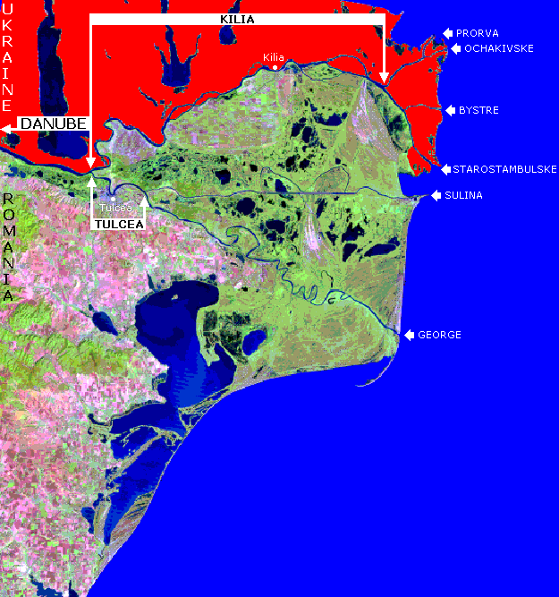
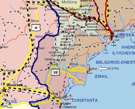
RFE/RL at APPENDIX: RFE/RL DISCUSSES SNAKE ISLAND (or at its place of original publication at www.rferl.org/~) may be worth reading for further detail, despite its preference for the Russian "Bystraya" instead of the Ukrainian "Bystre," and despite its placing Snake Island due east of the Romanian port of Sulina instead of, more accurately, due east of the Ukrainain Dragon's Beard, and despite its fantastic proposition that Ukraine is developing the Bystre Canal for the sole purpose of being able to offer Romania abandonment of that project in return for Romanian abandonment of its claim to Ukrainian oil and gas in the vicinity of Snake Island � a fanatastic proposition in view of Ukraine's clear right to both develop the Bystre Canal and own the resources in the vicinity of Snake Island � both without having to offer Romania any bribe. As with most coverage of the Bystre Canal, this RFE/RL report takes a position so contrary to Ukraine's interests that it could have been written by the Greater Romania party, Romania Mare. The RFE/RL proposition is quite as fantastic as Romania's invitation to Ukraine (as reported by Romanian irredentist Aurelian Teodorescu) to simply hand over the Dragon's Beard to Romania gratis, as has already been quoted further above, and whose revelation of Romanian arrogance prompts its being repeated here:
The Romanian delegation proposed that the document should provide, among other things, that the borderline along the Chilia Channel will follow strictly the middle of the navigable waterway as far as the point of entry into the sea.
Prof. Dr. Aurelian Teodorescu, "Serpents' Island Between Rule of Law and Rule of Force," 06-Oct-1999
www.tomrad.ro/iserpi/ENGLISH.HTM
|
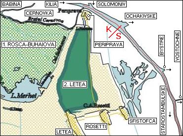
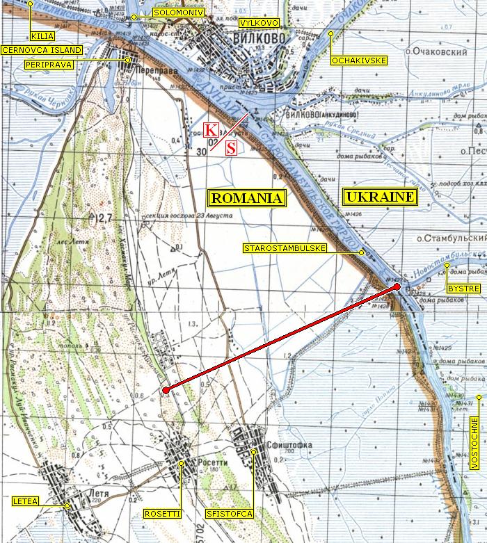
It is perhaps in part because of this undersea oil and gas that Romania wishes to push Ukrainian maritime activity as far north as possible, and why Ukraine, in its turn, prefers to develop the more southerly of the available passages through its Delta. Every ship that passes through a southerly Ukrainian canal solidifies Ukrainian jurisdiction over its southern territories, including approaches which maritime vessels follow out in the Black Sea.
If confirming ownership of Snake Island resources plays a role in Ukrainian motivation to develop a southerly canal when more northerly options exist, then it must be acknowledged that Ukraine acting upon such motivation is not only a proper exercise of its rights, but also a commendable expression of its prudence and foresight.
| 5. Romania Is Motivated By Irredentist Longing |
| A. Romanians yearn for their Greater Romania |
|
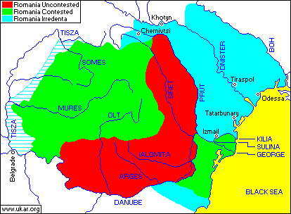
MAP: GREATER ROMANIA.
|
Understanding Romanian leadership is assisted by MAP: GREATER ROMANIA in which the red Romania Uncontested shows that part of today's Romania which over the past century has consistently stayed in Romanian hands; in which the green Romania Contested shows that part of today's Romania which over the past century has also belonged to other countries; and in which the violet Romania Irredenta shows that area which today belongs to countries other than Romania, but which over the past century has found itself under Romanian control.
One might imagine that Romanian leadership has the good sense to recognize that this map is representative of the corresponding maps of most countries in the world — which is to say that their point of greatest expansion has passed, and whereas they might today be seized by the impulse to make territorial claims based on past ownership on others, they are restrained by the recognition that others are equally capable of making territorial claims based on past ownership on them. Romania is particularly vulnerable to such claims against it being made by Hungary, as Romania's large western green area has been Hungarian territory in the past, and today is home to numerous Hungarians who sometimes inhabit substantial areas in which they constitute a majority. Romania's greed for Hungarian land is demonstrated by Romania having ventured so far as to demand, at the Paris Peace Conference in 1919, ownership of the area identified by horizontal stripes, which fortunately for the Hungarian nation, and more especially for the Hungarian people who live in the demanded area, Romania was not given.
It would appear, however, that elements of the Romanian leadership are unmindful of the considerations expressed above, and long for Romania Irredenta, uninhibited by either propriety or law, feeling themselves to be the rightful owners even if the territory in question was and is inhabited predominantly by non-Romanians � usually Hungarians or Ukrainians � and even if Romania once seized it by bloodshed and occupied it only briefly and dedicated itself to an orgy of ethnic cleansing, and suppression of language and culture � even in the face of all such considerations, some Romanians measure their self-worth by the area that their nation occupies, and refuse to accept the reduced self-worth of occupying anything less than Greater Romania.
To the impartial observer not gripped by the same fever, however, some irredentist claims have no greater legitimacy than would have an aging bank robber demanding legal title to a bank on the ground that he had held its employees hostage, and had enjoyed absolute rule over its premises, for a few hours in his youth. Or, better still, than would have a claimant of ownership of the bank by someone related to that hostage-taking bank robber of long ago only in belonging to the same biker gang.
A glance at acknowledgements of Romanian irredentism can begin with Arcady Zhukovsky's 1971 reference to it as an ongoing effort:
Rumanianization is further abetted by the current efforts of the government to secure the return of Bessarabia and northern Bukovina back to Romania.
Arcady Zhukovsky in Ukraine: A Concise Encyclopaedia, Volume II, University of Toronto Press, 1971, p. 1256b.
|
Romanian irredentism is not limited to fringe groups, but may include mainstream Romanian leadership, as for example the Romanian Foreign Minister:
Rejection by the extreme nationalists of any foreign policy moves that called the status of
"traditional" Romanian territories into question was a matter of first principles. [...]
The status of the contested territories and their inhabitants are highly charged issues in the
Romania political context. For extremists, such as those that support Romania Mare and the
Party of Romanian National Unity, the goal of a state encompassing all "traditional" Romanian
ethnic territories within its boundaries is a matter of first principle. [...] The significance of the issue for both sides was indicated by the
fact that 1996 Ukraine had reached bilateral friendship agreements with all of its neighbors
except Romania and Russia, despite the fact that all had potential territorial claims against it. [...]
Yet complete normalization of relations with the Western
powers continued to be hindered by Romania�s reputation as a haven for extreme nationalism,
and its failure to resolve outstanding problems with its neighbors, in particular, Hungary and
Ukraine. [...] A low point was
reached when Romanian Foreign Minister Teodor Melescanu commented in the Romanian
Senate that he doubted that the Island of the Serpents was in fact Ukrainian territory. Melescanu
suggested taking the issue before international bodies for deliberation. Ukraine�s Foreign Ministry
responded by characterising the statement as making a territorial claim against Ukraine, and
announced that the Ukrainian Ambassador would be recalled for consultations.
William Crowther, "Between Transdniestria and Serpent Island: The Evolution of Romanian Policy
Toward Ukraine," University of North Carolina at Greensboro
wwics.si.edu/ees/special/2000/crowther.pdf.
Footnote numbers removed.
|
Although useful for its acknowledgement of Romanian irredentism, Tony Barber writing below reveals his bias by demoting Snake Island from the status of an "island" to the status of "a rocky outcrop":
KIEV � When Ukrainians talk of threats to their security, they usually have Russia in mind. However, one of Ukraine�s most intractable foreign policy problems in the post-Communist age concerns not Russia but Romania. Apart from Russia, Romania is alone among Ukraine�s neighbours in not having signed an agreement on the inviolability of borders. Territorial disputes between Romania and Ukraine have proved so vexatious in the 1990s that President Ion Iliescu has postponed making an official visit to Kiev at least five times.
The reason lies in the infamous Molotov-Ribbentrop Pact signed by the foreign ministers of Stalin and Hitler in August 1939. Under this pact, the Soviet Union annexed from Romania the territories of northern Bukovina, southern Bessarabia, Moldova and a rocky outcrop called Serpent Island in the Black Sea. Of these four territories, three � Serpent Island, northern Bukovina (known now as Chernivtsy) and a strategically important strip of Bessarabia along the Black Sea � were awarded to Ukraine. [...]
None of this mattered much in the Communist period but, with the collapse of the Soviet Union in 1991 and the emergence of an independent Ukraine, nationalist Romanian politicians began to discuss publicly the prospects of recovering what were seen as "historically Romanian lands". Officially, the Bucharest government disclaims any intention of challenging Ukraine�s borders, but at the same time it insists that it will not sign a friendship and co-operation treaty with Ukraine unless the Kiev government denounces the Molotov-Ribbentrop Pact. Naturally enough, the Ukrainians suspect that if they make such a denunciation, they will make themselves vulnerable at some future date to a Romanian claim on Serpent Island, Chernivtsy and the strip of Black Sea coast.
Tony Barber, "Wartime legacy troubles Ukraine's borders," 22-Apr-1996
ourworld.compuserve.com/homepages/Harvey_Morris/kiev.htm |
Leading Romanian irredentist Prof. Dr. Aurelian Teodorescu finds that the merit of the Romanian claim to Snake Island is based on Romanian possession of it having been lawful, whereas USSR and later Ukrainian possession having depended on force, and therefore having been and continuing to be unlawful:
The case of the Serpents� Island provides a striking example of violation of the international law by those who have ruled over or still own illegitimately this Romanian territory. The rule of law operated as long as the island was legally placed within the frontiers of Romania as Romanian land; the rule of force applied when the island came under Turkish, Russian or Ukrainian jurisdiction. [...]
The current borderline is and must be considered a fact that lacks a sound and indisputable legal basis and following the disappearance of the predecessor state [the USSR], the issue of the borderline remains unresolved and needs to be settled. By concluding a treaty which would state in a legal form what was imposed by force and had no legal basis might appear as an act ratifying the fact; this would strengthen the legal foundation that Ukraine needs in order to maintain possession of this territory.
Ukraine can not possess something that the former USSR never owned legally. Ukraine can not consolidate and legitimate what was �taken over� from the former USSR. The conclusion of a border treaty between Romania and Ukraine under such conditions would trigger an unwelcome impact on the public, both at home and internationally, causing an adverse effect on Ukraine. At the same time, the indefinite delay in concluding an equitable agreement might emphasize the revisionist perception usually associated with the USSR and the successor states.
Prof. Dr. Aurelian Teodorescu, "Serpents' Island Between Rule of Law and Rule of Force," 06-Oct-1999
www.tomrad.ro/iserpi/ENGLISH.HTM.
Bold and italics were in the original.
|
However, in acquiring Snake Island, the USSR did not kill a single person or drop a single bomb or fire a single shot. It did not mass troops. The USSR did not ethnically cleanse the island or suppress the language and culture of its inhabitants, as the island had been uninhabited and unused. When irredentist Teodorescu talks of force, then, he conjures up images that have no counterpart in the history of the USSR acquisition of Snake Island. What Teodorescu must mean is that the USSR appeared ready and able to use force, or in other words that the USSR intimidated Romania into relinquishing claims to the island, which is not quite the same as its having used force. However, as at that time the island appeared to have negligible value, possibly the level of intimidation was inappreciable, and in fact immeasureable and unprovable. And it is also possible that in return for Romania relinquishing any claims to the island, the USSR made concessions to Romania. It may be the case, in other words, that Romania was less intimidated than rewarded. It would not be surprising if international law looked with disapproval upon a nation attempting to abrogate a treaty or an agreement or a border adjustment on the excuse that at the time of signing almost sixty years ago it had felt coerced, as this would invite wholesale challenges by those who in retrospect thought they deserved a better deal, which in many cases might be both parties to the agreement, or all parties.
| B. The Romanian seizure of Bukovyna in 1918 |
In turn, the Teodorescu claim that Romanian occupation of irredentist lands has been based not on force but on law deserves a detailed reply, as the historical record attests to the quite opposite record of Romania habitually relying on violence to expand Greater Romania into Ukrainian territory.
Here is a brief description of Romania's 1918 seizure of Bukovyna (whose northern half is ethnically Ukrainian) from the crumbling Austrian Empire:
On 4 November, these leaders and their supporters formed a joint Romanian-Ukrainian provisional government, which two days later forced the Austrian officials to surrender their governing authority. They also agreed to divide the province, so that the northern half might become part of the West Ukrainian National Republic.
These developments bore little fruit, however, because the majority of Bukovina's Romanians had other plans. Just two days after the Ukrainian Committee was formed, on 27 October, Romanian deputies from the Austrian parliament and Bukovinian diet joined the local political activists to establish in Chernivtsi their own national council. Led by Iancu Flondor, the Romanian National Council opposed any division of Bukovina, expecting that the entire province would soon be 'reunited' with Romania. When the Romanian-Ukrainian provisional government replaced the Austrians on 6 November, Flondor responded by calling on Romania to send troops. Five days later, a Romanian force entered Chernivtsi, the Ukrainian Sich Riflemen withdrew without resistance to Galicia, and all of Bukovina was annexed to Romania.
Robert Paul Magocsi, A History of Ukraine, University of Washington Press, 1996, p. 517.
|
Orest Subtelny describes the effect of the Romanian occupation of Bukovyna in 1918, and of the Western Allies recognizing the Romanian claim to all of Bukovyna in 1920:
The third group was the most vibrant Ukrainian community: the approximately 310,000 Ukrainians of Bukovyna. Romanian occupation resulted in a drastic political decline for the Bukovynians. Under Austrian rule, Bukovyna had been an autonomous province and Ukrainians, its largest national group, had relatively strong political representation in Vienna, extensive local self-government, and a well-developed system of Ukrainian-language education. All this was lost when the Romanians annexed the region. From being the most favored West Ukrainian community, the Bukovynians became the most oppressed.
Romanian intolerance of its numerous minorities was even greater than that of the Poles. After 1920, when the Western allies formally recognized the Romanian claim to all of Bukovyna, the Romanian government shut down all Ukrainian schools and even refused to recognize the Ukrainians as a distinct nationality. The educational measures of 1924, which Romanized the schools, referred to Ukrainians as "citizens of Romanian origin who had forgotten their native language." By 1927, all traces of Bukovyna's former autonomous administration had been removed and it was treated like any other Romanian province.
Orest Subtelny, Ukraine: A History (2nd edition), University of Toronto Press, 1994, pp. 446-447.
|
| C. The Khotyn uprising of 1919 |
Romanian occupation of Slavic peoples has been distinguished by two noteworthy uprisings: that of Khotyn in 1919, and that of Tatarbunary in 1924. The Encyclopedia of Ukraine outlines the Khotyn Uprising as follows:
|
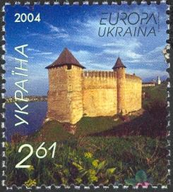
Khotyn Castle
|
Khotyn uprising. An uprising from 23 to 31 January 1919 by the Ukrainian inhabitants of Khotyn county against the Rumanian occupation of Bessarabia. It was directed by the so-called Khotyn Directorate, whose members (chairman: M. Lyskun; secretary: L. Tokan) established friendly relations with the Directory of the UNR. The UNR representative I. Maievsky supplied the three insurgent regiments � Rukshyn, Anadoly, and Dankivtsi � with arms. The rebels captured the town of Khotyn and most of the country's villages, and expelled the Rumanian authorities from the region. After fierce battles the Rumanian troops forced 4,000 rebels to retreat beyond the Dniester River together with about 50,000 refugees. The Rumanian authorities subjected eight villages (Rukshyn, Nedoboivtsi, Shyrivtsi, Kerstentsi, Stavchany, Dankivtsi, Vladychna, and Ataky) to severe reprisals. About 5,000 (15,000 according to Soviet sources) people were executed, 500 of them in Khotyn.
BIBLIOGRAPHY
- Dembo, V. Nikogda ne zabyt. Krovavaia letopis Bessarabii (Moscow 1924)
Okhotnikov, J.; Batchinsky, N. L'Insurrection de Khotine dans la Bessarabie et la paix européenne (Paris 1927)
- Heroïchna Khotynshchyna. Materialy naukovoï sesiï, prysviachenoï 50-richchiu Khotyns'koho povstannia (Lviv 1972)
- Khotinskoe vosstanie: Sbornik dokumentov i materialov (Kishinev 1976)
A. Zhukovsky
The Encyclopedia of Ukraine, Volume II, p. 493. Image added.
|
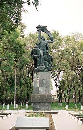
| D. The Tatarbunary uprising of 1924 |
The Encyclopedia of Ukraine outlines the Tatarbunary Uprising of 1924 as follows:
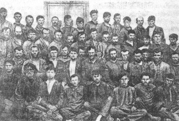
Participants in the Tatarbunary uprising (photographed in the Kishinev prison)
|
Tatarbunary uprising of 1924. A peasant uprising against the Rumanian occupation and for unification with the Ukrainian SSR which took place in Tatarbunary and in the neighboring towns of Bassarabia. It was the result of widespread dissatisfaction with the Rumanian agrarian reforms of 1921. A famine, a drought in 1924, and social and national discrimination against the Bessarabian population were also contributing factors. Nearly 4,000 peasants (Soviet sources claim 6,000) participated. The uprising was centered in Tatarbunary and was joined by residents of Akkerman, Bendery, Izmail, and Cahul counties. It began on 16 September 1924, led by a pro-Soviet revolutionary committee. After a three-day battle with Rumanian troops, artillery, and naval forces (on Lake Sasyk, near the Black Sea) the uprising was suppressed. Many of the rebels perished, and nearly 500 were arrested. The subsequent trial in Kishinev (1925) lasted 103 days, during which 386 of the accused were tried, of whom 86 were sentenced to prison terms ranging from 1 to 15 years. The trial drew international attention to Bessarabia and its colonial status. L. Aragon, H. Barbusse, T. Dreiser, A. Einstein, P. Éluard, R. Rolland, M. Sadoveanu and G.B. Shaw spoke out in defense of the Tatarbunary rebels.
BIBLIOGRAPHY
- Badulesku, A. Vosstanie v Tatarbunarakh (Moscow 1925)
- Salomon, R. 'Le procè monstre de Kichinev: L'affaire de Tatar-Bunar,' La Bessarabie et la Paix Européenne (Paris 1927)
- Smishko, P. Tatarbunars'ke povstannia 1924 r. (Kiev 1956)
A. Zhukovsky
Encyclopedia of Ukraine, Volume V, pp. 170-171. Color photograph of monument added.
|
| E. How Romania acquired Transnistria in 1941 |
Moving ahead to WWII, it might be recalled that it was not Germany alone that invaded Ukraine in 1941, but Germany together with Romania:
Not all Soviet Ukrainian territory came under German rule. The Romanians, who joined Germany's invasion of the Soviet Union, immediately reacquired northern Bukovina and all of Bessarabia, which they had ruled during the inter-war years but lost to the Soviets in 1940. By an agreement signed with Germany at Tighina on 30 August 1941, Romania also acquired the region known as Transnistria, located between the Dniester and Southern Buh Rivers. This included the large Black Sea port of Odessa, which did not fall to Romanian forces until mid-October, and only after the invaders had suffered losses of up to 70,000 dead and wounded. Although not annexed to Romania, Transnistria functioned as a self-governing province under the authority of the country's wartime head of state, Marshal Ion Antonescu. The local administration was headed by a civil governor, Gheorghe Alexianu, whose administrative residence was the town of Tiraspol.
The new administration viewed the local Romanian inhabitants, who represented only about 10 percent of the 2.3 million inhabitants of Transnistria, as the vanguard of a Great Romania beyond the Dniester River. In an effort to enhance the Romanian character of the region, new Romanian-language elementary and secondary schools were opened, a Romanian Scientific Institute was created to coordinate all forms of cultural activity, and a Romanian Orthodox Mission was established to coordinate the work of 250 missionary priests from other parts of Romania, who together with a nearly equal number of local priests tried to serve the 700 churches and chapels that used Romanian in their liturgies. These romanianization efforts continued throughout the war, until the arrival of the Red Army in 1944.
Robert Paul Magocsi, A History of Ukraine, University of Washington Press, 1996, pp. 624-625.
|
The Romanian treatment of Ukraine's Jews is a blot on the Romanian record. Here is a brief mention by Bartleby concerning Odessa:
Despite a heroic defense during World War II, the city fell to German and Romanian forces in Oct., 1941. It was under Romanian administration as the capital of Transnistra until its liberation (Apr., 1944) by the Soviet Army. Many buildings were ruined, and approximately 280,000 civilians (mostly Jews) were reportedly massacred or deported during the Axis powers' occupation.
Bartleby www.bartleby.com/65/od/OdessUkr.html
|
And here is a brief mention by Magocsi:
According to an agreement between Germany and Romania, perhaps as many as 100,000 Jews were deported between 1941 and 1943 from Bukovina and Bessarabia to Transnistria, where they were held in concentration camps for use as forced labor. Thousands died as a result of the deplorable conditions in the camps or other scattered atrocities, such as the killing of 26,000 Jews when the Romanians captured Odessa from the Soviets in October 1941.
Robert Paul Magocsi, A History of Ukraine, University of Washington Press, 1996, p. 632.
|
And here are more detailed allegations from the United States Holocaust Memorial Museum (USHMM):
ODESSA
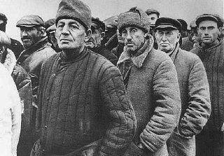
After the occupation of Odessa, Ukrainian Jews wait to register. Odessa, Soviet Union, October 22, 1941.
Saechsische Landesbibliothek
|
|
A Black Sea port in the southwestern Ukraine, Odessa had a population of nearly 600,000 in 1939. Roughly 180,000 were Jews, about 30 percent of the total. On June 22, 1941, Nazi Germany and its Axis allies, including Romania, invaded the Soviet Union. In August 1941, Romanian troops set siege to Odessa. The city surrendered on October 16, 1941. At least half of the city's Jewish population had fled Odessa before Axis troops surrounded the city. Between 80,000 and 90,000 Jews remained in Odessa after the Romanian occupation.
Odessa became the administrative seat of Transnistria (the area of the Ukraine between the Bug and Dniester Rivers which was under Romanian control between 1941 and 1944). On October 22, 1941, a bomb exploded in Romanian military headquarters in Odessa. The blast killed 67 people, including the Romanian military commandant, 16 other Romanian officers, and four German naval officers.
Using the incident as an excuse, Romanian army units assembled 19,000 Jews in a public square in the harbor area and shot many of them. They doused others with gasoline and burned them alive. At least 20,000 other Jews were assembled at the local jail and then taken to the village of Dalnik. There, the Romanians shot some of the Jews and locked others into warehouses that they then set ablaze. Romanian troops shot and killed any Jews trying to escape the fire.
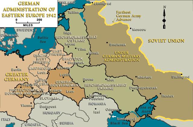 German administration of eastern Europe, 1942
In November 1941, the Romanian authorities ordered the remaining 35,000 Jews in Odessa into two ghettos, Dalnik and Slobodka, established on the edge of the city. Many died of exposure, disease, and starvation over the next three months. In January and February 1942, Romanian police and military personnel deported the surviving 19,295 Jews from the Odessa ghettos to Romanian-administered camps and ghettos in the Berezovka region in Transnistria, including Bogdanovka, Domanevka, and Akhmetchetka. During 1943, SS detachments made up of local ethnic Germans murdered the remaining Odessa Jews, along with other Jews deported to the camps in Berezovka from elsewhere in Transnistria.
The Soviet army liberated Odessa in April 1944.
United States Holocaust Memorial Museum at
www.ushmm.org/wlc/article.php?lang=en&ModuleId;=10005476 A white arrow has been added to show the approximate location of the Bystre Channel, and to reveal graphically just how far beyond the Bystre Romania's territorial ambitions have dared to extend, and what a large incursion of Greater Romania into Slavic lands some Romanians may dream of repeating � the large incursion right up to the Boh River which corresponds to the violet area toward the north-east in MAP: GREATER ROMANIA above, or in the map library at MAP: GREATER ROMANIA. |
To sum up concerning Romanian treatment of Ukrainian Jews:
It should also be emphasized that Romania was the only member of the Axis whose Jews were not sent to extermination camps in Poland by the Nazis. Rather, the Romanians killed them on their own, by means of activating their armed forces and police within Romanian-controlled areas and those areas in the Ukraine that were allocated to them by Hitler.
Yad Vashem
www1.yadvashem.org/about_yad/press_room/press_releases/romania.html
|
| F. How Romania rewarded Basil Bilivsky for encouraging people to study Ukrainian |
Since 1958 Ukrainian cultural life in Rumania has been increasingly subjected to harsh pressures from the authorities. As a result, almost all schools with Ukrainian as the language of instruction have been closed. [...] All Ukrainian national and cultural activity in the villages was prohibited, as was the use of Ukrainian names of localities in publications.
To frighten the Ukrainian intelligentsia the Rumanian authorities staged a show trial in 1959 accusing Basil Bilivsky of encouraging people to study the Ukrainian language and Ukrainian culture. He received a prison sentence of seven years. A similar trial of Ukrainian cultural workers was held in Sighet.
Arcady Zhukovsky in Ukraine: A Concise Encyclopaedia, Volume II, University of Toronto Press, 1971, p. 1256a.
|
| G. How Romania treats Ukrainians today |
And writing in 1994, historian Orest Subtelny described the contemporary plight of Ukrainians under Romanian rule as follows:
The Ukrainians of Romania, numbering an estimated 70,000, are probably the worst off of all Ukrainians in Eastern Europe, both in socioeconomic and in national terms. Scattered in such regions as southern Bukovyna, Dobrudja, Maramarosh, and Banat, they are isolated from each other and from Ukrainians in the USSR and in the West. Most are indigent peasants. Because Romania is one of the poorest East European countries, its Ukrainian inhabitants have limited opportunities to improve their socioeconomic status.
The discriminatory policies of the Bucharest government make matters worse. Up to 1947 the government refused to recognize Ukrainians as a distinct nationality. Matters improved somewhat during the relatively liberal 1948-63 period, when Ukrainian-language schools were allowed to function in the villages. About 120 were established with an enrollment of over 10,000 pupils. At the University of Bucharest, a section of Ukrainian language and literature came into being. But in 1964 a reaction set in and the government gradually nullified many gains of the previous years. Today, the cowed Ukrainian minority in the country does not possess a single communal organization.
Orest Subtelny, Ukraine: A History (2nd edition), University of Toronto Press, 1994, pp. 568-569.
|
And now to supplement the refutation (begun above with respect to Snake Island) of Romanian irredentist Prof. Dr. Aurelian Teodorescu's claim that Romanian rule over Romania Irredenta was based on law, whereas rule of these same regions by non-Romanians has been based on force.
It cannot be said that Ukraine ever shut down all Romanian schools under its jurisdiction, and treated Romanians as "citizens of Ukraine who have forgotten their native Ukrainian language" � whereas Romanians did inflict the corresponding wrongs on Bukovyna Ukrainians starting in 1920. It cannot be said that after a Romanian uprising against Ukrainian oppression, Ukraine forced 54,000 Romanians to flee westward across the Siret River, subjected eight Romanian villages to severe reprisals, and executed 5 to 15 thousand Romanians � and yet Romania inflicted the corresponding suffering on Ukrainians following their Khotyn Uprising of 1919. It cannot be said that after an uprising of Romanian peasants against Ukrainian oppression, Ukraine tried 386 Romanians and sentenced 86 of them to prison terms ranging from 1 to 15 years � and yet Romania inflicted the corresponding wrong on Ukrainians following their Tatarbunary uprising of 1924. It cannot be said that Ukraine ever participated in a Nazi invasion of Romania, and regarded a region in which Ukrainians comprised only 10 percent of the population as a slice of Greater Ukraine which happened to lie west of the Siret River � and yet Romania perpetrated the corresponding injustice when it occupied Transnistria in 1941. It cannot be said that in the course of invading Romania, Ukraine executed tens of thousands of Romanian citizens, and herded tens of thousands more into concentration camps, and deported many tens of thousands more � and yet Romania has committed the corresponding crimes against Ukrainian citizens in the course of invading Ukraine in 1941. It cannot be said that Ukraine ever sentenced a Romanian to seven years in prison for the crime of encouraging people to study the Romanian language and Romanian culture � and yet Romania did sentence Basil Bilivsky to seven years in prison for the crime of encouraging people to study the Ukrainian language and Ukrainian culture. It could not be said in 1994 that "today, the cowed Romanian minority in Ukraine does not possess a single communal organization," yet that is what could be said of the cowed Ukrainian minority in Romania.
In short, it would appear that territorial expansion by means of force has come entirely from the Romanian side, and that Romanian irredentist Prof. Dr. Aurelian Teodorescu is better at playing the role of a Romanian irredentist than he is at playing the more intellectually-challenging role of a "Prof. Dr.".
| H. Irredentist anger may help explain the arrogance with which Romania opposes the Bystre Canal |
In short, the preponderant attitude of today's Romanian administration toward its Ukrainian neighbors may be a continuation of Romanian predispositions established at least as far back as living memory goes � which predispositions are to invade, occupy, oppress, and murder � all in the interests of establishing a Greater Romania. With this habit deeply entrenched, some Romanians gaze across the Kilia arm of the Danube not at Ukraine, but at Romania Irredenta which Ukrainians temporarily happen to occupy, and from which they even have the impudence to launch economic competition which eats into Romanian profits, and from which Romania Irredenta the Ukrainians will need to be expelled, or at least conquered and forced to speak Romanian. To the Ukrainian effrontery of daring to compete with Romania, old Romanian habits call forth a Romanian temper tantrum, and that is an apt description of the Romanian reaction to Ukraine's daring to dredge silt off the floor of the Bystre Channel.
People who live in glass houses shouldn't throw stones. Radio Free Europe/Radio Liberty reports Moldovan President Vladimir Voronin claiming that the Romanian provinces of Moldavia, Transylvania, and Dobruja were under "Romanian occupation" and that Romania is the only surviving empire in Europe http://www.infoukes.com/rfe-ukraine/2004/0105.html. Hungary, in turn, publishes maps showing the locations of the vast numbers of Hungarians presently living in Romanian territory that had been formerly ruled by Hungary. If all historical claims were to be aired, Romania would find itself beset from more directions than merely Moldova and Hungary.
| I. Romania needs to educate its backward |
The irredentists within Romanian leadership constitute a dangerous pocket of backwardness in a country which might benefit from implementing a broad program to eradicate backwardness:
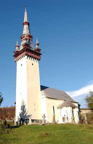
|
Dead dug up for rural Dracula ritual
Romania | Family exhumes teacher to cut out heart, end sickness
BY MONICA PETRESCU
BUCHAREST � It was just before midnight as Gheorghe Marinescu and five of his relatives crept into the graveyard in the small Romanian village of Marotinul de Sus. They knew which plot they were looking for � a simple earth grave with a wooden cross bearing the name Petre Toma � and quickly, but quietly, set about digging.
When they had dragged the body out, they waited. Then, at the stroke of 12, Marinescu began the ritual they had been planning for weeks, one that had passed from generation to generation in their family. They drove a pitchfork through Toma's chest, opened it, drew out his heart and then put stakes through the rest of his body. They sprinkled garlic over the mutilated corpse and then, carefully, laid it back in its grave.
They left the cemetery with the heart impaled on the end of the pitchfork and went to a crossroads where Marinescu's wife, son and daughter-in-law were waiting. There the group burnt it, dissolved the ashes and then drank the solution.
The scene last July would fit readily into any number of films about vampires and the Dracula legend but Gheorghe Marinescu is real. Last week he and his five relatives � Mitrica Mircea, Popa Stelica, Constantin Florea, Ionescu Ion and Pascu Oprea � were sentenced to six months in jail for the unlawful exhumation of the body of Toma, 76, a former teacher and a man they believed had risen from the dead to drink their blood while they slept.
News of what the Marinescu family did made headlines in Romania, but in a country where a large minority of the population admit to openly believing in the "undead," football bosses employ witches to cast spells on foreign teams, and a couple recently named their new-born son Dracula after premonitions of impending danger to him, many were unsurprised by what they read. [...]
But while Dracula and vampires are just a fascinating legend to most people outside the country, to many Romanians, mostly in rural areas, they are a terrifying reality. After his arrest, Marinescu said: "If we hadn't done anything, my wife, my son and my daughter-in-law would have died. That is when I decided to 'unbury' him. I've seen these kinds of things before.
"When we took him out of the grave, he had blood around his mouth. We took his heart and he sighed when we stabbed him. We burned it, dissolved the ash into water and the people who had fallen sick drank it. They got better immediately. It was like someone took away all their pain and sickness.
"We performed a ritual that is hundreds of years old. We had no idea we were committing a crime. On the contrary, we believed that we were doing a good thing because the spirit of Petre was haunting us all and was very close to killing some of us. He came back from the dead and was after us."
Marinescu explained to police when he was arrested that Toma, who he said had been a respected and well-liked teacher in the village for years, had been buried on Christmas Day in 2003. But soon afterward he had begun to appear to members of Marinescu's family in dreams as a vampire. Although he did not see the man himself, he saw his family become sick and they told him Toma was not just a dream, but a vampire.
He, like the rest of his family, had been told how to recognize vampires and how to deal with them by his parents who had been taught that knowledge from their own parents and they from theirs. He said he had had to act quickly to save his family.
Paula Diaconu, who has lived in Marotinul de Sus for decades, praised the ritual carried out by Marinescu and his relatives. "It was all a good thing to take his heart out because people were in danger. Villagers in Romania know about rituals for driving away the evil spirits of the dead," he said.
Another man from the village, Dumitru Moineasa, once drank a solution containing the ashes of his uncle's heart. "An uncle of mine died in 1992 and a few days after we buried him I started to feel very sick," he said. "The doctor had no idea what was wrong with me. One day, an aunt brought me a glass of water. I drank it all. I got well almost immediately. I only found out later that it was my dead uncle's ashes."
His friend, Domnica Brancusi, said that hearts had been taken out of dead men's chests many times before. "There have been dozens of dead men who turned into vampires and were haunting us," he said. "But usually the family of the dead man who was haunting people made a pact with those people and agreed not to say anything about the rituals. Until this case, no fuss was ever made about it."
Local police laid charges against the six men after Toma's daughter, Floarea Cotoran, who has since left Marotinul de Sus, complained about what happened. They admitted they were aware of similar rituals having been performed in the region. A policeman in nearby Celaru, which has jurisdiction over Marotinul de Sus, and who asked not to be named, said: "We've known about it for years. There's never been anything we could do about it as no one ever complained." [...]
Sunday Telegraph
The Vancouver Sun, 10-Feb-2005, p. A9. Poster originally at
www.asdfplus.com/MoviePosters/Cover-Dracula.htm A curious incongruity is the claim that someone is able to drink a glass of water, and realize that it contains ashes not by seeing it and tasting it, but only by being told.
|
| 6. Romania Is Emboldened By NATO Support |
Romania's acquisition of NATO membership promises soon to involve the stationing of American troops, and the building of American airbases, on Romanian soil:
WASHINGTON, March 11 (UPI) — Insider notes from United Press International for March 11
Here comes the new NATO — on the shores on the Black Sea and short Stealth bomber flight away from the Middle East. Bulgaria's Cabinet has now approved a $80 million deal with NATO to expand its airfield at Graf Ignatievo and upgrade its Bezmer airbase. The two sites will eventually house U.S. troops. Bulgaria joined the military alliance April 2004 and expects shortly to host American forces as the Pentagon shifts further from its Cold War deployments in Central Europe and Asia to smaller sites in countries such as in Bulgaria and Romania that are closer to potential Middle Eastern conflict zones. The Bulgarian government offered the bases, located in the southern part of the country, as sites for the Pentagon for use primarily as training sites. According to NATO supreme commander Gen. James Jones, the Pentagon is ready to begin negotiations with both Bulgaria and Romania about hosting U.S. troops. Bulgaria and Romania are eagerly promoting their ports, firing ranges, airfields and other sites to the United States and NATO officials in the hope of attracting investment needed to close the enormous wealth gap with the European Union.
Interest Alert, 11-Mar-2005
interestalert.com/~
|
Perhaps from the NATO-countries' point of view, a NATO aspirant — which is what Romania has been over most of its years of opposition to the Bystre Canal — can do no wrong. Even this NATO aspirant's illicit activities such as disseminating disinformation, protecting its monopoly, suppressing competition, contaminating the Danube River, and ruining the Danube Delta will be supported by the NATO countries so long as these activities disadvantage mainly non-NATO victims. Romania offering to place its territory at the service of NATO may help explain not only some of the riotous support that Romania has received in its war against Ukraine's monopoly-busting Bystre Channel, but also some of the imperiousness and swagger with which Romania has conducted that war.
If NATO support of disinformation campaigns, and NATO permission to desecrate the environment, should turn out to be perquisites of joining NATO, then countries which have no wish to best their neighbors by lies, or to ruin the environment, might view such perquisites as disincentives for joining.
|


 SATELLITE: ENTIRE DELTA WITH KEY LANDMARKS SUPPLEMENT


 Uncaptioned Rosia Montana scenes at


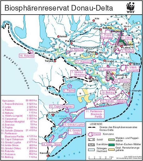 MAP: ROMANIAN KERNZONEN. WWF depiction of the Danube Delta Biosphere Reserve, originally at
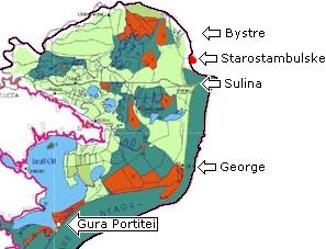
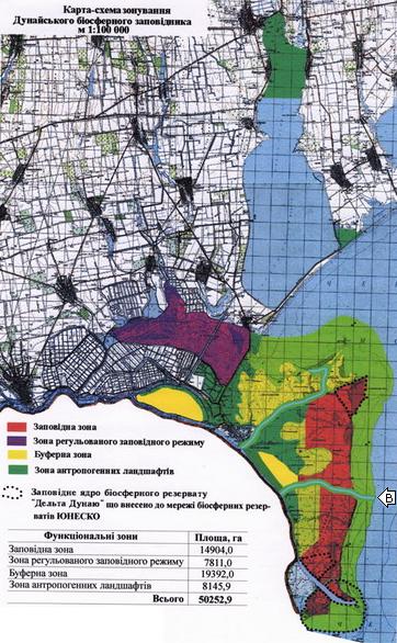
 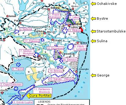 MAP: ROMANIAN KERNZONEN-2. Detail from Map Romanian Kernzonen for purposes of clarification, modified by the addition of labels with arrows pointing to significant mouths of the Danube, by the thickening of the existing but faint dashed line through the Kilia indicating that the Biosphere Reserve boundary corresponds to the boundary between Ukraine and Romania, by the coloring red of the Dragon's Beard which lies to the west of the Starostambulske mouth, and by redrawing the pink dots which enclose Romania's Strictly Protected Zones as dark blue. Noteworthy is the acknowledgement that the Danube Delta Biosphere Reserve is not a homogeneous area, but rather is an area of limited responsibility within which lie areas of higher responsibility — the "Kernzonen" or "Stictly Protected Zones" which, however, can be seen to occupy only a small proportion of the total Reserve. It may come as a surprise to some conservationists that even a UNESCO Strictly Protected Zone does not stop Romania from building a tourist resort such as the one at Gura Portitei which appears to fall within Strictly Protected Zone 11 — the Zone called Periteasca-Bisericuta-Portita. Of greatest significance is that Romania sets up its Kernzonen so that they will not overlap the Sulina or the George Canals.
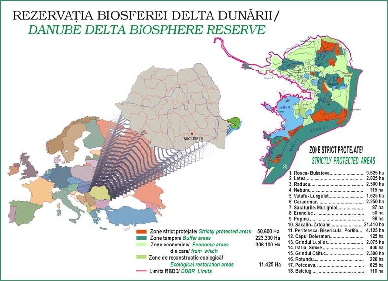 MAP: ZONE STRICT PROTEJATE-1. This map is not as clear as others because it is smaller and because, except for a few Kilia islands, it does not show Ukraine. The Starostambulske mouth is a faint line, without any outline of Ukrainian territory to either its east or west, although the distinctive curve at the point where the Biosphere Reserve boundary, following the international border, excludes the Dragon's Beard is unmistakable. Close peering reveals that the George unmistakably bypasses its six large meanders with shortcut channels.
 BBC Romanania [article in Romanian]
 Korrespondent [article in Russian]

