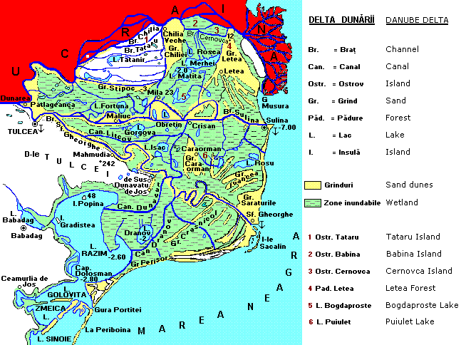
 Gura Portitei can be seen on the Black Sea coastline, toward the lower left. Ukraine, originally white in the above map, needed to be painted red to distinguish it from contiguous white areas lying in Romania. The cultivated right-angled triangle below Kilia (discussed in DISPLAYS xx and xx) being rendered white in the original of the map above, as it remains here, suggests that the cartographer who prepared the map considered it removed from the Danube Delta wilderness which is represented in color. The meandering George Channel has not yet been reduced to the straight George Canal. The Tataru Island identified in the legend and in the map by a "1" is the Romanian Tataru Island; the Ukrainian Tataru Island is marked with a white square, and is located to the right, and a bit below, the "C" in "UCRAINA." English legend added. The original map is at www.geocities.com/dmarioara/images/Delta.GIF
|